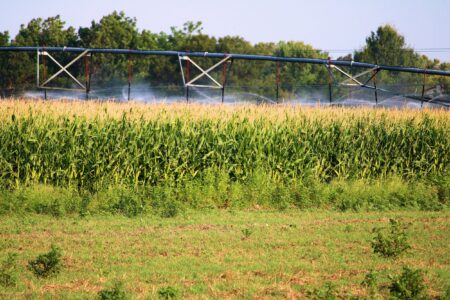
The most recent U.S. Drought Monitor shows that abnormal dryness (D0) and short-term moderate (D1) to severe (D2) drought continued to expand across the lower to middle Mississippi Valley, Ohio Valley, Central Appalachians, Northeast, and Southeast last week. It wasn’t all degradations, heavy rainfall of 2 inches or more brought a 1-category improvement to parts of central and eastern portions of Kentucky and Tennessee.
Midwest
Central and southern Missouri saw widespread 1-category degradations based on 30 to 60-day standardized precipitation index (SPI), soil moisture, National Drought Mitigation Center blends, and impact reports. Poor pasture conditions, low farm pond levels, and increasing stress on soybeans have been reported across southwestern and south-central Missouri.
Short-term D1 continues to expand across Illinois, eastern Indiana, Ohio, and western Kentucky following several weeks of below-normal precipitation.
In Ohio, impacts include rapid crop dry down, water hauling, low farm ponds, and poor pasture conditions. In southwestern and west-central areas of Illinois, trees are prematurely dropping leaves and soybean production is poor.
“Most of southern Illinois and southwest Indiana received less than 0.1 inch of rain during August and so far, no rain in September,” said Phil Krieg, agronomic service representative for Syngenta Crop Protection. “Our last rain at home was July 22 when we received 0.6 inch.”
Hay growers in Krieg’s region won’t be able to get a fourth cutting of alfalfa this year since there hasn’t been any rain since the last cutting.
“The mood is pretty poor right now,” said Krieg. “Yields of the ‘early’ corn, which is May-planted, are at least 30-50 bushels off last year’s yields and the outlook for June planted corn is even worse. Corn planted in the last half of June pollinated poorly due to the heat and the dry conditions during grain fill took away more bushels. Ears have dropped prematurely and that is never a good sign of a strong grain fill period.”
In contrast to these widespread degradations, southeastern Kentucky saw a 1-category improvement thanks to more than 2 inches of rainfall.
Jared Goplen, Wyffels agronomy manager in northwest Iowa, southern Minnesota, and eastern South Dakota, is starting to think about cold weather.
“We had two to three nights late last week and into the weekend that got very cold,” said Goplen. “Some areas in my coverage area down around 35°F and even a few stations registering closer to freezing. I haven’t heard any frost reports, however, and don’t expect to.”
In his territory, the weather has been conducive to late grain fill.
“Moderate temperatures with relatively good sunshine — I expect crops that have kept their green color to continue adding on bushels,” said Goplen.
High Plains
Central Kansas picked up more than 2 inches of rain, while southwestern Kansas recorded 1.5 inches or more, leading to a minor reduction in D0. Eastern Kansas, however, saw a slight increase in D0 and D1. Southern Colorado improved with 0.5 to locally 2–3 inches of rain, but northern Colorado slipped from D2 to extreme (D3) drought due to worsening SPI values.
Much of the Dakotas, Nebraska, and eastern Wyoming remain drought-free.
In Nebraska, Travis Gustafson, agronomic service representative for Syngenta Crop Protection, has been experiencing very cool temperatures for the season.
“There were a couple nights that dipped down into the mid-40s with highs mostly in the 70s,” said Gustafson. “Eastern Nebraska had some significant rainfall move through over the Labor Day weekend, but the rest of the state remained dry.”
Gustafson hears that most growers are expecting decent yields but not necessarily record yields.
“Disease and a dry August has taken its toll on the corn crop in Nebraska,” he said.


:max_bytes(150000):strip_icc()/Updated3BigThings-3-soybean-harvest-yellow-1-13b4e68e77bc41d8bd69b3b910ff5300.jpeg)

:max_bytes(150000):strip_icc()/cerealryecovercropsUSDA-b131fd0b2c584da7a22485faa6f182c6.jpg)


:max_bytes(150000):strip_icc()/Corn-Roots-August-2025-e53215bb28ad48af895c6428ebaddee6.jpg)


:max_bytes(150000):strip_icc()/100441307_dairy_cow-2b8693c4806c45a1aa0e89b45bf0ab00.jpg)
:max_bytes(150000):strip_icc()/WhiteHouse-2000-251df9c5b90d4c7da5a9226a5c8f9dac.jpg)